
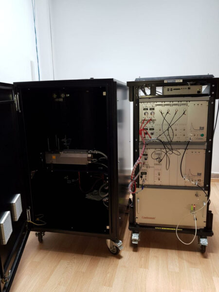
The mobile laser remote sensing system, the LR231-D300 multi-wavelength Raman depolarization LIDAR, is used for the study of the planetary boundary layer and atmospheric aerosols. It provides information on the dynamics of aerosol layers in the atmosphere and the planetary boundary layer as well as the optical scattering and extinction coefficients of the aerosol at multiple wavelengths.
Technical characteristics:
- The LR231-D300 multi-wavelength Raman Depolarization LIDAR system is compliant with ACTRIS CARS national aerosol remote sensing facility standards. It features elastic channels at 355 nm, 532 nm, and 1064 nm, as well as RAMAN channels at 387 nm and 607 nm, and a depolarization channel at 532 nm.
Operational procedure:
Considering the specificity of the LIDAR system measurements, which require the use of special protective glasses, it can only be used under the supervision of authorized personnel, upon request and taking into account weather conditions and the mandatory measurement schedule within the European LIDAR system network it is part of.
It is recommended to schedule measurements 14 days in advance by contacting the laboratory manager, Lect. Dr. Eng. Nicolae Ajtai (email: nicolae.ajtai@ubbcluj.ro) or CS III dr. Horațiu Ștefănie (email: horatiu.stefanie@ubbcluj.ro).
The cost of a set of measurements is free, but in case of intensive use, the necessary consumables (laser flash lamp, cooling filter, etc.) must be provided. Data processing is carried out according to the European LIDAR system network EARLINET protocol (https://www.earlinet.org/index.php?id=earlinet_homepage), using the Single Calculus Chain (upon request). Previews of existing measurements can be seen on the website: https://quicklooks.earlinet.org .